
Geodetic Surveys

Accurate survey data is the foundation of most geospatial solutions, and we capture this through survey capability from land, water, and air. With our Geosurveys expert land survey teams and state-of-the-art remote sensing equipment (mounted on our aircrafts, UAVs, and boats), the GeoSurvey team provides this critical layer of data for our marine and terrestrial solutions. The team also delivers surveying services directly to the local, state, and federal governments, and private sector organization involved in engineering, construction, forestry, mining and minerals.
IIC Technologies draws on its multi-disciplinary skill set to integrate the cadastral surveys, land information services, and data management services to deliver parcel mapping solutions for both private sector and government.


 Geodetic Surveys
IIC Technologies has an experienced and dedicated team of professional surveyors that can undertake the necessary work to design, observe, and establish geodetic systems and infrastructure needed to form the basis of land development and management. This includes pre-analysis and design, triangulation, installation of survey monuments, and set up of GPS based control stations. IIC Technologies is equipped with the state-of-art digital surveying instruments and technologies.
Our mapping & data processing department rely on CAD, GIS, and the latest database software tools in the processing and analysis of field data
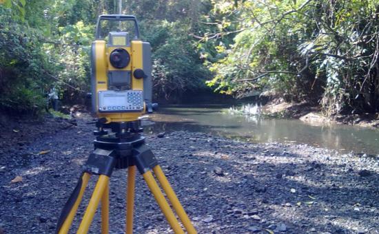
Engineering Survey
At IIC Technologies, we realize the significance of integrating the position of natural and man-made features on or beneath the Earth’s surface as a critical part of any engineering project. We also realize the importance of their relationship in the planning, design, and construction of civil works. IIC Technologies provide quality engineering services with a thorough understanding of the technicalities and project risks. Equipped with the latest digital surveying instruments and technologies, our mapping & data processing experts rely on CAD, GIS, and the latest database software tools in the processing and analysis of field data.
Cadastral Mapping
IIC Technologies has undertaken many cadastral mapping projects for legal boundary surveys for the Government of India. This includes consultation and boundary determination expertise. The practice of finding and establishing boundaries is neither a purely legal process, nor a purely scientific process. Armed with multiple years of experience and learning, IIC Technologies team has mastered the process. IIC Technologies has developed the process and procedures in finding the old survey while being cognizant of the legal description of the land and the many conflicts which may affect it. This involves not only knowledge but skills in research and investigation.
Throughout the process IIC Technologies apply the concepts of good measurements to find and describe what is found, and the ability to interpret its relationship to the land record. At IIC Technologies we find this work rewarding and fun; being a mathematical detective, with archeology, dendrology, geology and paralegal aspects thrown in.
Hydrographic Surveys
IIC Technologies has an excellent reputation for providing hydrographic services and solutions for both government and industry. Over last two decades, IIC Technologies has conducted extensive work in support of hydrographic surveys and charting from data collection, processing and cleaning, analysis to chart production and database management. Our team of experts consists of professionally accredited and experienced hydrographers, engineers, geophysicists, CAD, IT experts and qualified support staff. IIC Technologies has direct experience in conducting hydrographic surveys for navigational charting purposes. Whether it is a small harbour survey or a large offshore project, IIC Technologies has capabilities to bring the expert team together to deliver a quality product, on time, and within budget.
Aerial Surveys
IIC Technologies possesses Cessna Grand Caravan 208 B Aircraft, fully modified to undertake Aerial Surveys using high resolution imagery and LiDAR technologies. IIC Technologies has Intergraph DMC II 230 large format digital mapping camera and Leica ALS70 airborne LiDAR sensor. Possession of these aerial assets, enables us to provide end-to-end services in Terrestrial solutions using aerial technologies and topographic mapping.
Our qualified and experienced geomatics experts ensure that our clients receive the very best in aerial surveying. With experience over years our team of experts can assist in flight planning and photo acquisition, LiDAR acquisition and processing, processing of satellite imagery, photogrammetric scanning, ground truth collection, and high precision photogrammetric mapping.
To complete the full circle of services IIC Technologies offers complementary services such as seamless orthophoto generation, digital terrain / elevation models, 3-D visualization, volumetric calculations, and GIS/data conversion and translation.
Learn More about Aerial Surveys
Geophysical Surveys
Decoding physical properties of Earth’s crust
Geophysical surveys are undertaken from air, water, or land, and the information is delivered through geospatial applications for analysis and decision support. Once the data from these surveys is processed it can be used across many domains.
Multiple survey methods
Geophysical surveys are usually conducted through on-ground and aerial activity (with tight-drape flight paths).
Depending on the size of the survey area and target of the exploration, different survey methods are deployed)
Software application and portals:
To enable users to access, interpret, analyze and make decisions, the survey information is combined with other data, and delivered through a geospatial model and interface, using static and 4D (time-lapse) models. This can be accessed through web-based portals or applications that run on mobile devices.