
Aerial LiDAR Survey for preparation of Detailed Project Report of Mumbai – Hyderabad High Speed Rail Corridor:
posted in development by admin
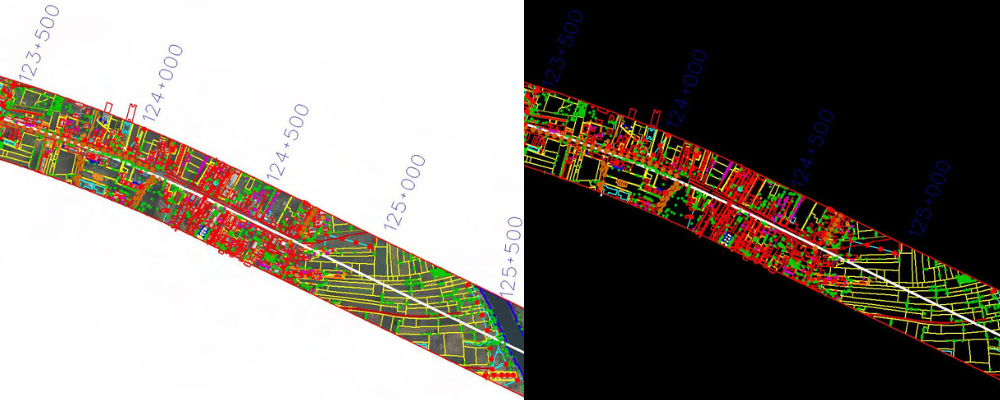
IIC Technologies have executed Aerial LiDAR Survey for the Mumbai-Hyderabad High Speed Rail project which connect Mumbai, Pune, and Hyderabad through 11 stations in Maharashtra and Telangana covering 736 Km.
The aircraft was equipped with state-of-the-art aerial lidar and imagery sensors, made its maiden flight from Pune and started gathering information related to the ground survey. The detailed information was collected in less than 30 survey days which includes information on various terrains, hills, rivers along the proposed route. A 100-megapixel camera is also used along with laser and GPS data to provide accurate survey data.
During the Aerial LiDAR Survey data was collected for 150 m of area on either side of the proposed alignment. After the collection of data, Three dimensional (3D) Topographical map of the corridor on a scale of 1:2500 was mapped for designing the Railway line. These maps are being utilised to identify the affected trees, structures, Plots, Land requirement for the corridor, Location of stations, Right of way etc.
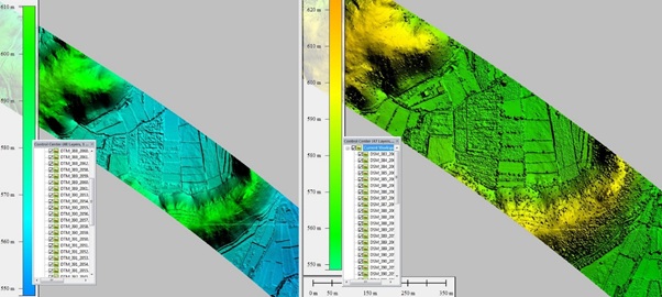
Digital Terrain Model and Digital Surface Model