Now loading.
Please wait.

menu

Industries

Home Ports and Inland Waterways
Ports and Inland  Waterways

Ports and Inland Waterways

Helping port administrators and operators to address key challenges of growth, safety and profitability.

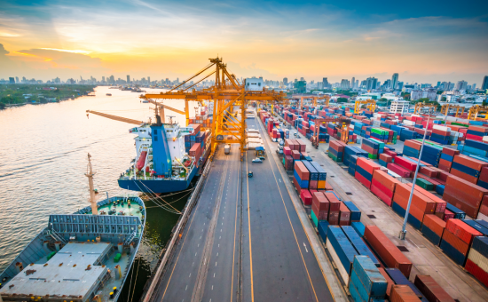
Geospatial management solutions enable the port operators and administrative agencies to address
their key challenges, in a growing but cyclical industry. Governments across the world are focusing on
making port operations more efficient and the use of inland waterways for passenger and goods
transport.


IIC technologies’ ports and inland waterways solutions and consulting services address key
opportunities and challenges for operators ranging from international mega ports, to private jetties and
inland waterways.


Our solutions help with -

  • Navigational Safety: Ensure safe transit of vessels in and out of the ports and terminals, amidst increasing traffic volumes, increase in size and weight vessels
  • Operational Efficiency: Doing more with less space is the new mantra. There is a need to intelligently manage key port assets like parking bays, dumping areas, cranes, approach roads and rail tracks, etc. to increase efficiency, utilization, and uptime.
  • Cost saving and Congestions risk management: Traffic management, pre-booking of facilities online, for saving anchorage time and cost, while driving occupancy rates.
  • Growth and profitability, through economic cycles: Assess growth initiatives and manage impact of environmental factors, while increasing capacity and driving up revenues.

IIC ports and inland waterways solutions

Feasibilty Surveys
Feasibility surveys
Feasibility surveys – Key to large-scale national and international projects, this is the first step in identifying and validating which waterways that can be used for navigation. This involves data acquisition, processing and analysis to determine technical feasibility of a given stretch of wa....
R&D Projects/ Research Studies
R&D Projects/ Research Studies – To enable ports to develop,analyze, and design expansion plans, incorporating siltation issues and solutions. We undertake Research studies for sea-ports and inland waterway terminals, including data collection (hydrographic, topographic, and geophysical), ....
Port Operation Navigation Services
Port Operation Navigation Services – To ensure safety of navigation, determining the optimum time-windows for vessel movements and maximizing utilization of port resources To maximize revenues while maintaining safety standards, a series of services are rendered either as one-off studies or reg....
Engineering solutions
Engineering solutions – Required before taking on engineering and construction activities that involve altering or managing flow of water Geospatial technology provides key support in proactive situations in the early stages of engineering projects, as well as reactive situations where availabi....
GIS based asset management solutions
GIS based asset management solutions – To help port operators monitor and manage port assets and enable collaboration between different operational functions through common data layers. GIS based asset management solutions allow management of all port assets including facilities, buildings, s....
Data Services
Data Services – Are the building blocks for many applications and services to ascertain river navigability, enhance navigation safety, and save cost by optimization of passage plans We provide key hydrographic surveys and data processing to help navigation authorities, service providers, and v....
River navigability solutions
River navigability solutions – For supporting navigation planning, safety and efficiency, and providing ecommerce platform for distribution of data. This is a family of inter-related products that support day-to-day needs for the authorities and operators: Navigation Charts (paper and el....

IIC Value Chain

Feasibilty Surveys Feasibility surveys

Feasibility surveys – Key to large-scale national and international projects, this is the first step in identifying and validating which waterways that can be used for navigation.

This involves data acquisition, processing and analysis to determine technical feasibility of a given stretch of water for navigation. They key deliverables of such a study include recommendations on: 

  • Limitations of vessels
  • Infrastructural requirements (intermediate terminals, etc.)
  • Proposed Navigation gates and locks to maintain water levels
  • Historical data and analysis to gather annual patterns and variances

R&D Projects/ Research Studies

R&D Projects/ Research Studies – To enable ports to develop,analyze, and design expansion plans, incorporating siltation issues and solutions.

We undertake Research studies for sea-ports and inland waterway terminals,
including data collection (hydrographic, topographic, and geophysical), data processing and analysis to provide recommendations on the technical feasibility & environmental impact of the design.


Management of siltation is a critical function in keeping a port operational. Our siltation solutions
include:

  • Siltation Analysis on the amount, pattern, and type of siltation
  • Nautical depth study to determine which vessels navigate through the passage
  • Dredging solutions
  • Recommendation on type of dredging
  • Determining optimum dredging windows

Port Operation Navigation Services

Port Operation Navigation Services – To ensure safety of navigation, determining the optimum time-windows for vessel movements and maximizing utilization of port resources

To maximize revenues while maintaining safety standards, a series of services are rendered either as one-off studies or regular updates, depending on the nature of the port.

  •  E-Navigation solutions which comprise of a suite of offerings, customized to suit the requirements of the port operators. Some of the deliverables in this suite are:                            
    • Port ENCs
    • Navigation Solutions
    • Seabed analysis
    • Current and wave data services & analysis
    •  Weather data services & analysis
    •  Meta-analysis
  • Dredge monitoring surveys and dredge volume analysis with recommendations on where to dredge and dump, to maintain navigability
  • 3D terrain views for detailed terrain information
  • These projects are delivered either as one-off or recurring contracts where the conditions are more dynamic due to impact of tides, weather, and currents.

Engineering solutions

Engineering solutions – Required before taking on engineering and construction activities that involve altering or managing flow of water

Geospatial technology provides key support in proactive situations in the early stages of engineering projects, as well as reactive situations where availability of geospatial tools helps in managing unpredictable natural and man-made situations. Some of the offerings include:

  • Inundation analysis also known as flood plain mapping, to predict the areas, and features which would get inundated with different amount of rainfall or alteration of flow and terrain caused by other activities like construction dams, bridges, roads, etc.
  • Flood forecasting and warning systems that use combination of geospatial data, historical analysis, and a network of sensors that and give advance warning of probable flooding.
  • Digital Elevation Models
  • Disaster management solutions (warning, planning, evacuation recommendations) - preventive measures

GIS based asset management solutions

GIS based asset management solutions – To help port operators monitor and manage port assets and enable collaboration between different operational functions through common data
layers.

GIS based asset management solutions allow management of all port assets
including facilities, buildings, storage areas, rails & roads, plots, jetties and
wharves. This centrally located feature database supports collaboration between different functions
required to monitor and maintain the ports. Some of the key benefits and deliverables are:

  • Web and mobile based app for dynamic information retrieval and display of all static assets in ports
  • WebGIS to show layers of information coming from ERP as well as other third party port systems
  • Real-time sensors data integration with the WebGIS linkage with ERP and IoT RFID usage in the port
  • CCTV cameras stitch view from various points in the port into WebGIS and MobileGIS
  • RFID “Track and Trace” with ISPS compliance for ports. Tracking vehicles movement within the port areas or plots on roads
  • Energy audit layer of the key ports assets property; security protection and law enforcement; and transportation motor pool operations.

Data Services

Data Services – Are the building blocks for many applications and services to ascertain river navigability, enhance navigation safety, and save cost by optimization of passage plans

We provide key hydrographic surveys and data processing to help navigation authorities,
service providers, and vessel operators to ply in a cost effective and safe manner. This
comprises data from multiple sources including BATHYMETRIC, GEOPHYSICAL AND
GEOTECHNICAL surveys. Pattern analysis of such data, in combination with weather
information provides for day-to-day decision making. This data is updated and published
periodically, or pushed to electronic devices on barges and other vessels. These services are
relevant to sea ports as well as inland navigation.


River navigability solutions

River navigability solutions – For supporting navigation planning, safety and efficiency, and providing ecommerce platform for distribution of data.

This is a family of inter-related products that support day-to-day needs for the authorities and
operators:

  • Navigation Charts (paper and electronic)
  • Charting solutions e.g., ECS (electronic chart system)
  • Web-based/app-based navigation desk
  • Platform for distribution charts including subscriptions and payment systems,
  • Environmental Impact Assessment (EIA) studies to develop long term scenarios