

Software solution and system integration
Productivity through Innovation
The Innovation Center (IC) at IIC Technologies provides system integration services and software applications that bring actionable geospatial data to the decision makers. This requires integrating the geospatial solutions seamlessly with other enterprise systems like ERP and e-commerce applications, delivering quick returns on the investment in geospatial technology.
Intellectual property comprising products, reusable components, and industry-specific frameworks developed at the Innovation Centre, enable us to deliver customized solutions quicker, with time-tested modules. These innovations apply across industries, including the marine, defense, aviation, heritage and government sectors.
At the core of this capability, is a group of specialized resources with rich domain experience and software engineering expertise. This group works in close collaboration with our multidisciplinary teams and our clients to innovate, design, develop and deploy powerful software applications.
IIC Technologies’ experience with application development, legacy application maintenance, process automation and data dissemination in different environments, including proprietary and open source platforms offers unrivaled flexibility to customers in designing and developing their integrated solutions.

IIC Technologies is a premier partner of Bonitasoft, a leading provider of Business Process Management (BPM) application platform. As Bonitasoft Premier Partner, IIC Technologies will gain access to exclusive technical resources, training materials and vendor support which are essential to providing expert-level Bonita BPM integration services. Tapping into the well-known Bonita BPM suite, will allow IIC Technologies to enhance its ability to provide enterprise solutions that facilitate process automation, improve productivity and, ultimately, help achieve better operational results by the end clients.
OGC compliant solutions: Nautilus Geoportal and I-Cadastre developed by Innovation Center (software solutions division) have been certified as OGC compliant.
The purpose of the OGC Compliance Program is to increase system interoperability while reducing technology risks. Vendors gain confidence that they are providing a product compliant with OGC standards, which will be easier to integrate and easier to market. Buyers gain confidence that a compliant product will work with another compliant product based on the same OGC standard, regardless of which company developed the product.
![]()
- Nautilus Geoportal, an enterprise-grade geospatial data sharing and content management platform capable of proficiently supporting a variety of operational and strategic end-users’ requirements. Developed in line with all modern industry best practices, properly factoring in high availability, load balancing, security, disaster recovery and other provisions it ensures top operational performance required for large implementations. It is based on a suite of Open Source components which provide a robust functionality needed to access and manage all data holdings while also providing the support needed to develop a full-featured web application, including demographic, economic, social and physical infrastructure data layers.
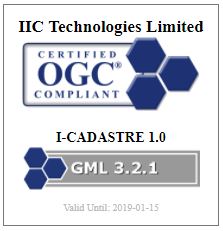
- I- Cadastre, a cadastral mapping software is a desktop application for capture and management of survey data and associated land records. The toolset covers all aspects of cadastral data management processes, from ingestion of raw survey data (topographic and aerial) through to the production of Land Parcel Maps. The application allows the end-users to create, view, query, and analyze the spatial data, and generate user-defined maps and reports. This can be achieved by uploading boundary data and land details collected by surveyors in the field when they connect to the main system. The system permits for upload of structured datasets from the filed along with relevant imagery and historical records. Information is then used by operators in the office to reconcile, validate and generate specialized Land Parcel Maps for verification and entry into land registers. The platform supports a variety of file formats, including: DXF, SHP, GML, and GeoTIFF.